
By: Niall Gibney
20hr 21min
“Why on earth do you want to do it in Winter?”asked my wife, Helen when I broached the idea. “Because no-one else has completed it in Winter,” was my reply, and that more or less set the tone for doing the round. But this time, I’m going anticlockwise!” I added, trying to convey some sort of sensible reasoning/rationale to Helen about my latest mountain running quest.
After completing the round in June totally unscathed I continued to enjoy the rest of the season in the hills with good performances in the seven sevens and Mourne Skyline races. It was whilst training for the Skyline that I started to think about an anticlockwise round and my initial thoughts were that it would be easier that way. How wrong I was….
From late October onwards I carried out many recces of the route noting/recording any features that I thought would be helpful for navigating in the dark. I recorded best estimate times for the different stages to help decide a start time for the round. I experimented with different layers of clothing to see what worked best. I invested in a decent head torch, some thick waterproof gloves and sailing socks to prevent cold extremities. I looked up dates for forthcoming full moons with 12th Dec and 10th Jan catching my eye. I opted for the weekend after Dec 12th, as I reckoned December had a habit of being milder and less stormy/chilly compared to January or February. As the date drew closer a touch of amnesia about a prior commitment rendered the weekend of Dec 14th unavailable, so Dec 8th it was going to have to be!
I opted for a 3am start. My thinking was that the 1st stage in the dark would require little in the way of tricky navigation and I would then have the benefit of daylight for the subsequent less familiar stages. I also thought the final stage in the dark would be fairly straightforward to navigate with mostly well worn hiker paths to follow. The week before the proposed round attempt I studied the weather forecast intensely, switching between different weather apps if it wasn’t to my liking! It changed all the time before finally settling on being windy, mostly dry during the day and for good measure the first storm of the season named by Met Eireann, (storm Atiyah), hitting our shores Sunday evening. A wee storm wasn’t going to put me off, sure it is a winter round after all I thought to myself and I would be nearly finished by the time it landed.
My support team was prepped and ready to rise to the challenge of providing a hot meal mountain side (a belated birthday present!) My good club mate and summer round accomplice Gavin Hynds offered to join me on the final leg without a second thought whenever he heard I was doing it, which gave me great relief. Ultra-Runner Aaron Shimmons who was the first runner to complete both clockwise & anticlockwise rounds gave me sound advice to save something for the final leg.
With all the training and preparations complete, all that
was left was to get a bit of sleep. The alarm clock was set and double checked that
it was set for am and not pm (see summer round report). As I sat eating my
porridge at 2am I saw light reflecting outside the house. The sky was fairly clear
and the half-moon shining brightly, happy days I thought to myself. I gathered
my gear, juggling a backpack, travel mug of tea, phone and car keys. As I tried
to open the car door, I dropped my phone, watching it bounce off the concrete. I
picked it up and to my horror the screen was black, phone dead. After a moment
of panic I remembered that I had a basic phone in the car that was charged and
thought that would do grand. Off I headed for Donard Park, Newcastle. I had
driven a few miles up the road when I suddenly remembered that part of the
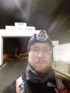
round rules was to take a start photo at the arch entrance to Donard Park. My basic phone was so basic it didn’t have a
camera! I did a quick u turn headed back for home, rummaged through a drawer
and picked the least broken of my collection of broken smartphones! With it now
plugged into the car phone charger I set off again for Newcastle, nothing like
a bit of drama to start off a Rankin round for me.
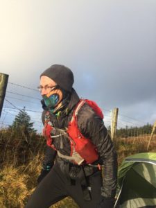
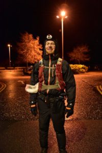
I got out of the car at Donard Park, switched on the trackers and walked to the arch for the obligatory photo with the broken back-up phone. As I did so, workers finishing their shifts in the local bars drove past giving me some strange looks. It was breezy and drizzly at Donard Park, so I wrapped up well and impatiently waited for the clock to strike 3am and off I trotted towards the forest.
Soon after passing the first bridge along the Glen River, I was met by some deer just like in the summer round, a good omen I thought. Further up when I left the path after the 3rd bridge heading for the stile at the forest corner a wild camper was out making adjustment to his tent, not sure which of us got the biggest fright!. As I climbed up the front of Commedagh, a route I had practised many times, I looked over and could make out Donard’s silhouette and thought I’ll see you later. Once I reached the ridge the weather really changed with strong cross winds trying to blow me over the ridge. I crouched down and kept moving slowly along and started the climb up to Commedagh summit. I was so relieved to hit the summit, albeit slightly behind schedule due to the wind. I continued to move slowly, crouched down along the plateau towards the wall, all the while hoping conditions would be better there. I crossed the wall and to my disappointment the wind was still relentless. I moved slowly downwards staying close to the wall trying hard not to slip on the grassy slope. It was wild. I remember thinking that if this continues, I’m going to pull out at Hares Gap. But somehow I seemed to keep fighting it, moving forward and even jogging parts. To my relief when I reached Hares Gap the wind had completely died down and I had made up the time lost during the 1st climb.
Staying by the wall, the climb up Bernagh was fine and again I took my time carefully descending the other side. Climbing Meelmore, I followed the wall on the left until reaching the boulder field and then veered off towards the summit. The strong wind returned at this point and I had to get down low once more, misplacing a few steps as I moved over the boulders. Once I reached the wall, I climbed over it and was pleased to be right at the summit. I moved forward to touch the pile of stones and as I did so a gust of wind blew me right over. A bit shaken but thankfully unharmed by this, I quickly decided to stick to the wall on the descent rather than my intended shortcut route down. Meelbeg and Loughshannagh were ticked off next and around now the windy conditions really improved. I remember jogging down off Loughshannagh and being so happy to see that Ott Mountain was visible. After the stile I stayed on high ground contouring around to the short climb up Ott. Just as I did, I saw a shooting star overhead, not sure what I wished for though! I proceeded straight off Ott Mountain on a great track onto the road below. I then followed a fence up to the stile and took the path up Slievenamuck. At the top here I had to get out my list of bearings for the 1st time of the night to help direct me towards Spaltha. Following my compass I dropped down and made the short climb up to Spaltha. From here it was downhill to Spelga car park. As I was running down I must have disturbed a nesting bird which flew up in front of me giving me a fright! I reached the toilet block in 3hr 38min, well ahead of schedule. I topped up my water from a stashed bottle I had left early the day before. To be honest, I had hardly drank anything and eaten just a banana up to this point. I had been feeling sick for most of the round. I blamed the 2am porridge, something I don’t routinely eat. My hands were feeling cold here too so I changed gloves. It seemed to take ages with me fumbling about trying to put on new gloves with numb fingers. Eventually I got my stuff together and headed for Slievenamiskan.
Coming off the top, my head torch caught a pair of eyes watching me at the bottom of Cock Mountain ahead. Not sure what it was, but it didn’t hang about to greet me. As I descended Cock Mountain on a bearing, jumping through the heather and grass, I could make out the outlines of the mountains all around me. But they didn’t look right. I had veered off course a bit too far South and was looking over to Pigeon Rock Mountain. No major loss and I re-adjusted my course, heading for the Mourne way and Rocky River below. I crossed the bridge there and plodded through a boggy section up to the path at the base of Rocky. As I descended Rocky, daylight started to make an appearance at long last. It was a great feeling to have gotten so far in the dark with only a minor wobble and was I now able to turn off my head torch. I jogged towards Pierces Castle, drinking some milk hoping it would settle my stomach. I stopped on top of the rocky slabs and forced a bread roll down.
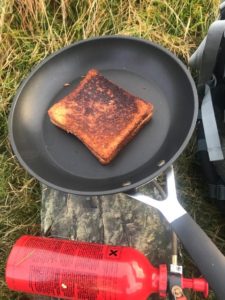
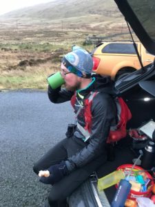
I then set off at a slow pace following the paths towards the wall and up to Tievedockarragh. From the top I could see the forest corner that I was heading for next. I then followed mountain bike trails down to and across the yellow water river and then on past Kilbroney red bog into the forest. This section was really wet and slippery and I fell a few times here, wetting my gloves. I emerged from the forest and double backed on myself following a bearing to the top of Slievemeel. From here, it was downhill through long grass to the fallows area of Kilbroney forest. As I made my way shuffling along the forest track I was met by a group of Newcastle AC runners lead by Seamus Lynch (also spotted on the summer round!). They stopped briefly and I told them what I was attempting. They wished me well, as only locals could with “keep ‘er lit!” I carried on the track, took a short cut through a section of forest and then followed a faint track up to Crenville, everybody’s favourite mountain! The climb up was fine. The descent down the other side was not! I’m not sure how many times I tripped navigating through the long tussocks, it was heavy going. I was glad to get out of it and climb my last hill before stopping for a break. My support team of Ian and James were ready and waiting for me at the Slieve Martin – Slievemeen col and I was more or less on time. They had gone to great lengths erecting a tent for me to shelter as well as carrying a load of kit/food up the mountain. I changed clothes and refuelled courtesy of a camping stove cooked toastie and a load of coffee. At this point my appetite still wasn’t great but I forced it down anyway, grateful for their support on a cold winter’s day.
I left the team to trot up the short climb to Slievemeen. From here, it was a nice downhill run on a grassy section all the way to the forest corner below. I entered the forest, talked to a group of walkers and carried on along the track. After emerging from the forest around the Rowans, I crossed the river and followed a good bearing to reach Finlieve summit. From here I followed another bearing to take me to Shanlieve across the lovely peat hags. As I was nearly across the plateau, the clouds lifted and I didn’t recognise the hill in front of me. After a few minutes of panic I started looking around and deduced where I was. I was slightly South West of Shanlieve summit. On a previous recce the cloud was so low that the mountain wasn’t visible at all hence why I didn’t recognise it, I had never seen it before. It was a great relief to see the summit pile of stones and be back at the wall. Eagle and Wee Moughanmore were next followed by a steep climb up Moughanmore. I stopped here at its summit to remember Denis. On my descent off it I started to feel hungry for the first time of the day and by the time I reached the river below I felt weak and light headed. I sat down on a rock and ate until I felt better. A short climb up Pigeon Rock and then I was freewheeling down to Deers Meadow where Ian and James were waiting. I was happy to reach there on time and stopped quickly for some more coffee and food.
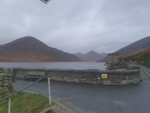
Next was the steep climb up to Slieve Muck. From here I had a nice run down towards Carn and then down to the stile at the top of Ott track. I followed the trail, contouring around the base of Slieve Loughshannagh and then cut across some boggy ground to reach the Ben Crom River. I followed this for a short bit before crossing and climbing through rough ground to reach the path to Ben Crom summit. A quick turn around and I was heading back down to cross the river and clamber up rough ground to Doan. On Doan, the wind and rain seemed to pick up and continued as I descended towards Loughshannagh lough. I had been looking forward to running down the track from here to the Mourne wall all day. Unfortunately the wind was so strong that I barely managed to break out of a walk. I even had my first taste of coke along here, (a great discovery on the summer round) but sadly it was to no avail. At this point I was really looking forward to seeing Helen and the kids at Silent Valley. Just Slievenaglogh stood between me and them. As darkness started to fall, I climbed it using the wall as a handrail and then dropped down the other side across some boggy ground towards Silent Valley. As I approached the reservoir, I could see Gavin and Finn waiting at the fence. It was great to see them. Finn wanted to race me and took off across the dam as I plodded along behind slowly. I was then met by Orla and Helen who had my kit all ready and more importantly, my pre-ordered gravy chip! I changed clothes, putting on full body waterproof gear in preparation for Atiyah’s arrival. I replenished my pack with food and a 2 litre water bladder before sitting down on the bench to get stuck into the gravy chip and coke. It was great!
With headlights on, Gavin and I left the gang to start the final and toughest leg of the round. Up Moolieve and Wee Binnian was OK, taking care passing its steep gully, but once on Binnian things started to deteriorate. I found the steep climb exhausting and I was moving very slowly now. In hindsight, the 2litre water bladder was a bad idea. I wasn’t used to carrying that extra weight and had been drinking from 500ml soft flasks all day. As we approached the top and left the Mourne wall, thick cloud descended, making navigation to the summit difficult. It was so cloudy that we had to convince ourselves that we were actually on the summit, visibility totally obscured. Finding the path down from it was equally as hard and at this point I did start to panic a bit. Somehow Gavin located the direction of the path and set off with me following behind. It was a huge relief to hit the wall at the back castles. Conditions were so bad that the path was just unrecognizable to me and I don’t think I was convinced that we were on the right path.
Thankfully we got off Binnian safely and started up Lamagan, a tough climb on any day. It seemed to drag on and on, one of those “are we nearly there yet?” climbs. Gavin was keeping me entertained, which helped distract from the fatigue setting into my leg muscles. From its summit we made sure to keep a close eye on the path following it down and then up to Cove. Around now Gavin gave me a gel sweet which seemed to go down well. With Cove and Beg bagged we were now at the Brandy pad which usually is a nice trail to run but not tonight. I tried to run only a short distance and ended up walking most of it to the wall. We followed the wall down to Rocky, the wind doing its best to blow us off course. From here, the path down to the stile at the wall was easy to make out. We crossed the stream and took the track up to the bend. On a previous recce I had paced from here to a good spot to turn right and on a bearing climb up a grassy strip, avoiding boulders in the process. Again I was struggling with the climb and as we picked up the path to take us to the summit the wind and rain worsened. From the top of Chimney Rock all the way down our faces were battered by the wind and heavy rain and my fingers had started to go numb by the time we got to the stile at the bottom of Donard. With just one climb left, Gavin handed me a gel to take to give me a boost. I needed it as this was a tough tough climb and like Lamagan seemed to go on and on. Staying close to the wall we were afforded some shelter from the wind. Finally we were at the top and the wind here was horrendous. Gavin joked about taking the blackstairs down. By now I was all picture and no sound and thought just get me off this bloody mountain! The descent was equally as painful. I held onto the wall taking small steps down. The tops of my feet at this point were aching and my hands cold again. As we neared the saddle I was hoping that the wind would ease, but it didn’t. Even much further down on the Glen river path, powerful gusts were nearly blowing us over. We tramped on down the path eventually reaching the forest. As we neared the edge of the forest I could hear some cheers. It took me a while to work out it was my support team and family who had been painstakingly tracker dot watching all evening, waiting for me to make an appearance. This time Orla dared me to race to the arch but I had finished with racing much earlier that day. In a daze, I walked across the car park, touched the arch and even managed a smile for the photo.
The round was over and I was now the first person to complete it in winter. To my amazement it had been 20 mins faster than my summer round! It was definitely tougher anticlockwise, Aaron was right about that last stage. The weather had not been kind, pretty much from the start the wind had been relentless and energy sapping, a proper winter round!
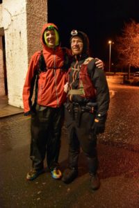
I never would have completed this Rankin round without the brilliant support and help of Ian, James, Helen, Orla and Finn. Although I started it alone I would not have finished had it not been for Gavin. For his company, encouragement, navigation, craic and sweets I will always be grateful. I would also like to thank Rowan from Primal Tracking for going out of his way to supply the trackers for the round.